Epic Hikes of Zion - Angels Landing and The Narrows
“The crest of the ridge, as it lay before us, first descended to a rugged gap, then swept up in a great craggy parabolic curve to the haunt of the Angels.”
The exciting part of Angels Landing trail - lower right to upper left along the ridge line
Zion National Park
It is easy to get swept up in a national park frenzy in southern Utah - Arches, Bryce, Canyonlands, Capital Reef and Zion. Each one magnificent and worthy of your time. Outdoor enthusiasts consider Zion to be a premier playground due to it's dramatic geology.
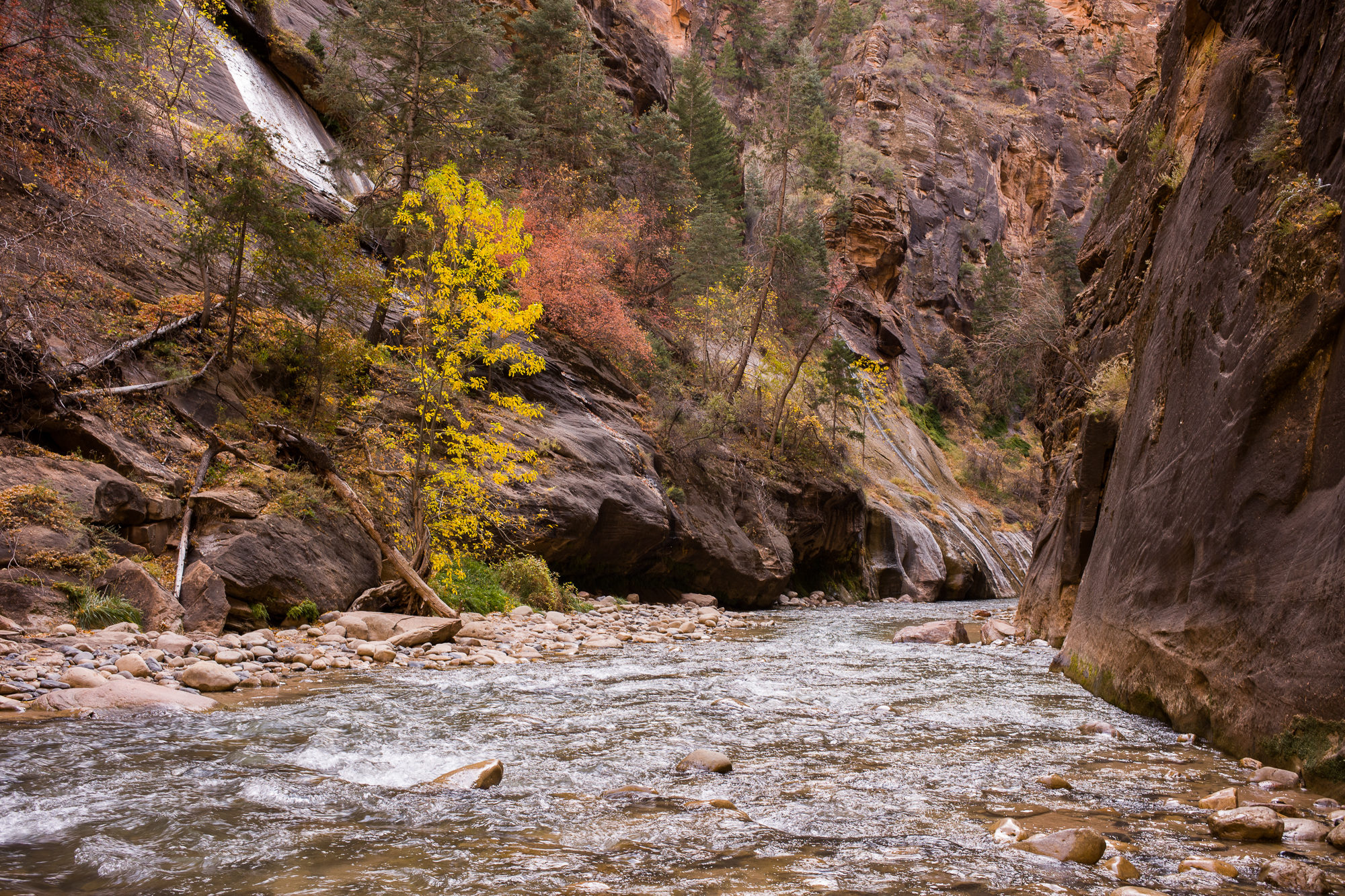
Angels Landing and The Narrows are 2 "epic" hikes in the park that do not require special skills. The hikes couldn't be more different. The pinnacle of the Landing is a knife edge crimson stone pathway surrounded by sky. The Narrows is a slot canyon carved by the Virgin River that wanders through vertical cliffs of rust colored stone. Both trails have risks, however, if you visit during the off season, November through February, you eliminate heat and crowds and occasionally have the park all to yourself!
Angels Landing Hike
Section 1 of the Angels Landing hike gently ascends from the Virgin River valley.
In 2014 Outside magazine named Angels Landing as one of the 20 most dangerous hikes in the world. Gazing up from the valley floor you see a huge stone monolith cutting though the sky. From this vantage point it is not obvious how to get from here to there. The first reported summiting was noted in the Christmas edition of the St. George newspaper in 1924. The paper claims that park ranger Harold Russell and guide David Dennet were "the first humans" to stand on the summit. This "first" is unlikely as Native Americans called Zion home for centuries prior to Russell and Dennet.
The hike has 4 distinct trail sections and begins at either the Grotto or from Zion Lodge. Section 1 is a paved, gradual, steady climb and is popular because the views from corkscrew path are stunning. You have the option of tacking on a couple mini trails and view the Emerald Pools or wander further along the Virgin River.
Eventually you get to a notch in the stone. Section 2 leads to "Refrigerator Canyon" so called because the shaded trail is often 10-15 degrees cooler. This oasis is narrow, beautiful and tranquil. The stone is colorful and cool to the touch. A wash in the canyon provides water for trees and brush. The trees in November were bursting with autumn color. The trail eventually makes a 180 degree turn to a set of steep switchbacks. Section 3 is named Walter's Wiggles after Walter Ruesch. Walter was the Zion Park superintendent and is credited with building the trail in 1926. After climbing Walter's 21 switchbacks and 400 vertical feet, you arrive at the saddle called Scout's Lookout which is an excellent place to stop, rest and enjoy a snack. There are plenty of beautiful views and this serves as the logical endpoint for most hikers.
From Scout's Lookout you see the trail and chains leading up the knife edge to Angels Landing
The paved trail stops and narrows here. Section 4 is steep and narrow. Sturdy chains attached to stone serve as handrails. This confining thoroughfare is traveled by climbers and descenders. Safely sharing the chains and the trail requires courtesy and patience as well as attention and focus. The park service reports that lives have been lost on this section. A Police Officer and Iraq veteran saved a girl from falling and claims this was the most frightening experience of his life. Many people decide this section is not for them. Respect this decision. But if you feel comfortable with the risk, the last section of trail is exhilarating and rewarding. Perhaps you will look back on this accomplishment with awe and satisfaction. Images from the Landing are below.
Hiking The Narrows
The Narrows is also not for everyone. Anyone weighing less than 80 pounds will likely find battling the current more of a chore than a pleasure. Tip - ask a park ranger if you have questions. The Narrows canyon stretches 16 miles through Zion. The Virgin River carved a path through the sandstone cliffs 2000 foot high on either side. Approximately 70% of the hike is in the river and , at times, the water is swift and cool. Proper gear includes neoprene socks, special boots, wading clothes and a sturdy wooden walking stick for stability. Tip - Leave your fancy carbon fiber walking sticks for another day because the carbon is prone to shatter on the river rocks. A fall into the cold, flowing river could ruin your day. Rent narrows hiking gear in Springdale. Even in late November, we witnessed a few foolish people who decided renting gear was unessasary. They looked miserable.
The risk of flash flood is real because the canyon is stone rather than dirt. Even with numerous warnings posted on along the river, unprepared hikers are trapped in the canyon every year. Use common sense and check the recommendations on the NPS site. The hike officially begins at either at the end of the Sinawava Trail (no permit required, simply depart at Shuttle Stop 9)) or Chamberlain's Ranch (permit required).
The Narrows Adventure
Many end up where The Narrows begins but most don't descend into the water. Entering the chilly river, you might experience the rush of new adventure emotions. Your ears fill with the echoing sounds of flowing water as you scan the sky through the narrow slit of stone. If you feel like you are walking inside the earth, it is because you are! Look down river and you see multicolored stones through a changing lens of running water. If you stare too long, the stones appear to move with the water and you might hesitate where to place your next step. To break the spell, don't look down. Instead, feel the river bottom with your feet and wooden stick. Keep your gaze ahead and observe the flow as some parts are deeper and quicker than others. As you continue, stop from time to time, and notice how others navigate the changing landscape. Adjust and always keep an eye on water currents that can be easily avoided. Plan your route through the river so you get to the next patch of dry land. Regroup. Soak in this rare experience. After 15 minutes in the river, time magically stops. You are on a solitary journey inside a slice of earth. As you round the bend, civilization is a memory. You are in a magical place. Is this what the Anasazi felt walking this canyon 1000 years ago? When the time is right, make your way back to your starting point. Tip - Conditions partially determine the logistics of changing into and out of your gear and is best discussed with your provisioner on the day of your adventure.
Hiking The Narrows
Zion History
According to the National Park website, human prehistory dates back 6000 years to the Archaic period. Hunter gatherers inhabited the area from 600BC for about 1000 years and archeological remains suggest the Virgin Anasazi and Parowan Fremont cultivated corn and squash on the river banks around 300 AD. For the next 800 years they permanently settled in the area. Around 1300 AD both the Virgin Anasazi and the Parowan Fremont disappear from the archeological record of southwestern Utah. It is suspected that climate change drove them elsewhere.
Recorded history begins in the late 1700s when traders traveled the Old Spanish Trail. In 1872, one-armed John Wesley Powell and the U.S. Geological Survey team surveyed Zion Canyon. In 1909, a presidential Executive Order designated Mukuntuweap (Zion) a national monument even though the area was still inaccessible by road or rail. By 1917, touring cars reached Wylie Camp, a tent camping resort. Shortly after, Zion became an official National Park and the Union Pacific Railroad increased access by building a rail spur from Cedar City. Even today, visitors travel along the marvelous the Mt Carmel-Zion highway by car. Building the highway required extraordinary engineering including chiseling a mile long tunnel through ruby sandstone cliffs.
Closing
Zion is beautiful, dramatic and accessible. Enjoy the Gallery of Photos for these hikes. Lodging is available inside the park at the Zion Lodge and various campgrounds or in the town of Springdale. Make sure to start your day with the best coffee in town at the Cafe Soliel. A couple great sites for planning Zion hikes are The Zion Guru and Joe's Guide to Zion. The Guru provides useful maps. Reserve your river gear and/or book a private guide from the Zion Guru.


